Vernon Tava
Skip to content
About
Media
Video
Maps
Screen Shot 2018-10-01 at 17.50.15
By
Vernon Tava
|
Published
October 1, 2018
|
Full size is
1399 × 648
pixels
42767820_10156207993009425_1468289854956634112_o
Screen Shot 2018-11-15 at 3.43.39 PM
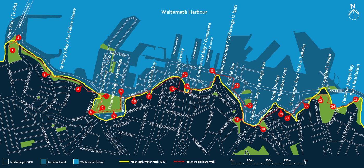
Map of the walk tracing the pre-1840 shoreline.
Bookmark the
permalink
.
Leave a comment
Cancel reply
Δ
Comment
Subscribe
Subscribed
Vernon Tava
Join 41 other subscribers
Sign me up
Already have a WordPress.com account?
Log in now.
Vernon Tava
Subscribe
Subscribed
Sign up
Log in
Copy shortlink
Report this content
View post in Reader
Manage subscriptions
Collapse this bar


